Results
Land Cover Change Detection
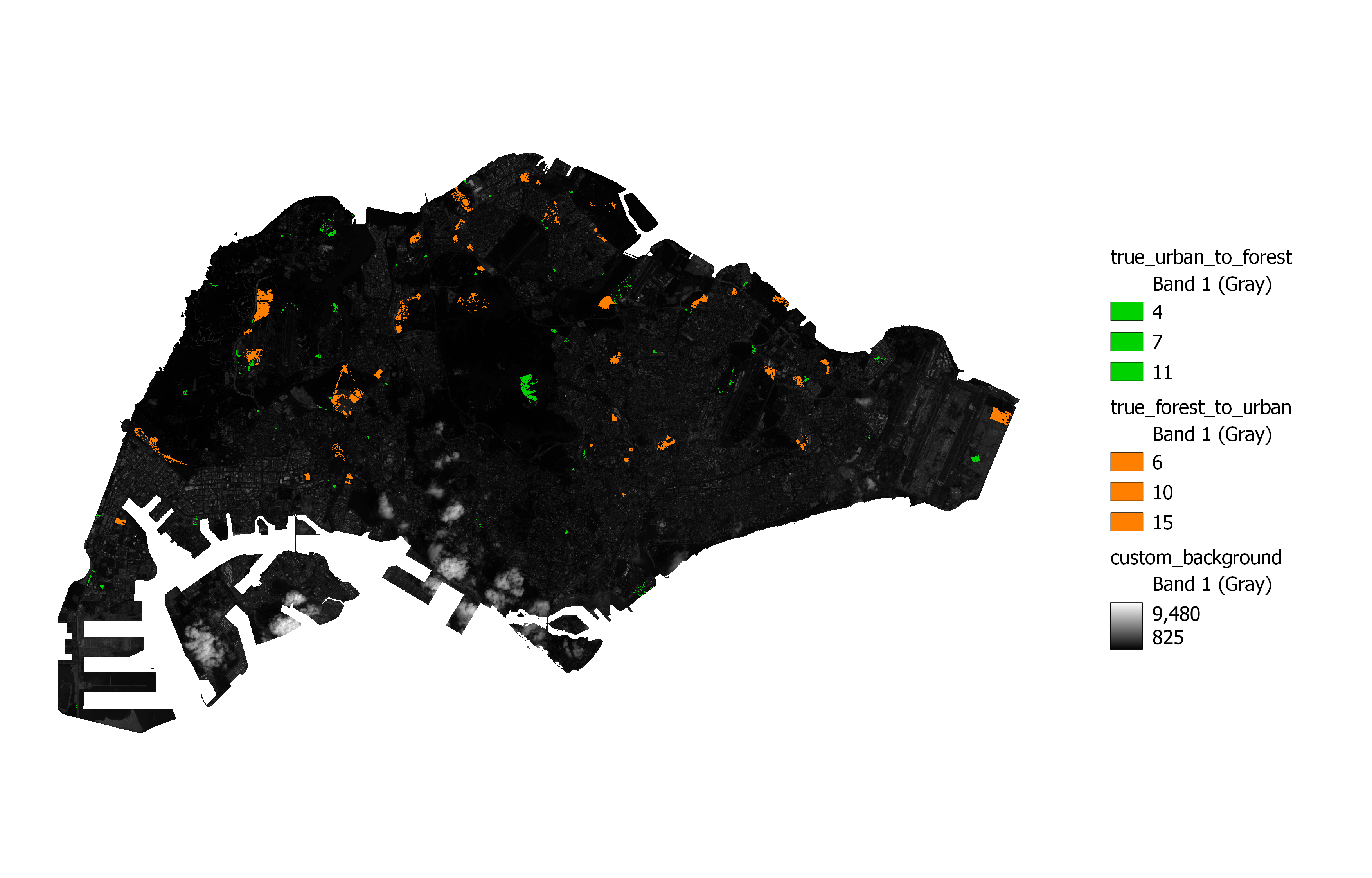
The above map is the output after cleaning the data. The map shows the areas whereby forests are removed and converted to urban areas (orange) and those areas where the vegetation is grown back from Urbanisation.
As mentioned earlier, we were able to use the change detection Cross Class Code to calculate the area of land that was converted from vegetation to urban infrastructure and vice versa. Specifically for the area of loss in vegetation, we were also able to calculate the proportion of land converted to bare land and buildings within the past 2 years.
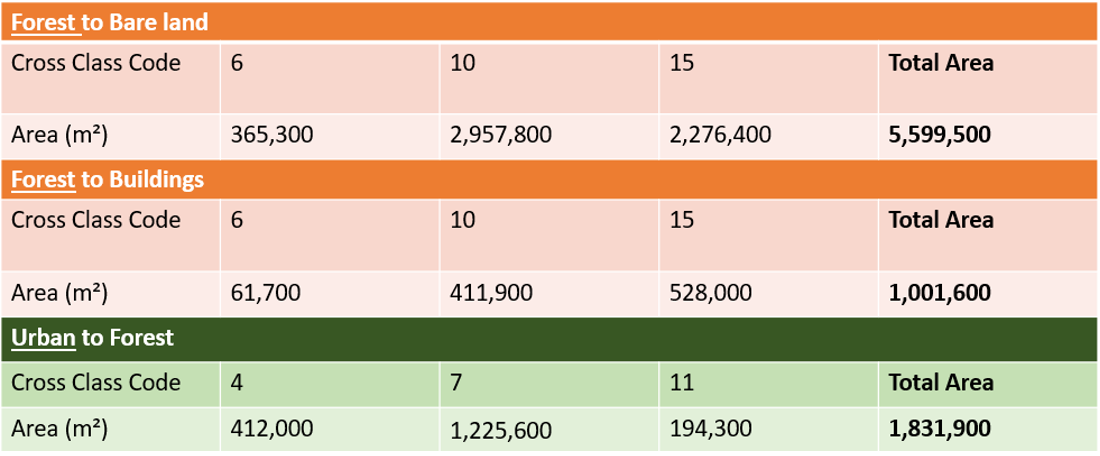
We have found that a total of 660ha of vegetation has been lost over the past 2 years. Of this 660ha, 80% of the land has become bare land and 20% of it has already been converted to buildings.
On the other hand, 180ha of new vegetation has been added within mainland Singapore in the past 2 years. Overall, this results in a net loss of 500ha of vegetation.
Change in Land Surface Temperature (LST)
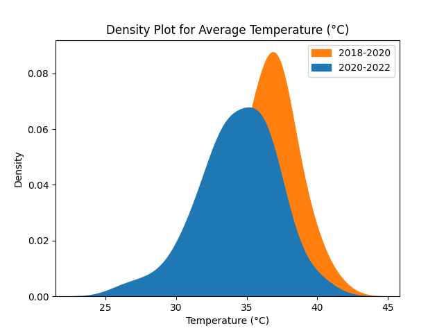
Within the past 2 years, and across all planning areas, we have found that LST has fallen by an average of 1.91℃. The figure below also shows that the height of the curve is shorter, which shows a more even distribution of lower temperatures across the island.
Discussion
Change in Land Cover and LST
Despite the government’s aim to add 1000ha of green spaces by 2035 according to the SG Green Plan, Singapore has lost 500ha of green spaces within the first 2 years. Most of this vegetation has been converted into bare land which is likely set aside for upcoming infrastructure projects. With the loss of vegetation in central regions, it is also of concern that the new green spaces may not be accessible for residents if they are only situated in far-off areas. While there is added vegetation within urban areas, it seems insufficient.
Given the net loss in heat-absorbing vegetation, the fall in average LST is a pleasant surprise. It can likely be explained by the government’s effective heat mitigating measures.
Additionally, this fall in LST could be due to the COVID-19 lockdown which restricted most human activity throughout Singapore.
Challenges
The following are some of the main challenges we faced during our analysis:
- Limited availability of good Satellite Imagery with low cloud cover
- QGIS and Landsat 8 images alone is inefficient in deriving the average LST
- Green buildings may be detected as vegetation by Satellite. QGIS is unable to classify a single pixel into multiple categories
Future Work
Given more time, there are several ways to add value to our research. Firstly, we could explore better methods to reduce noisy data in Land Cover Change Detection using SCP tools. Secondly, we could explore different classification methods and algorithms to achieve better accuracy. Lastly, future research can include an analysis on Land Use of urbanised land to study the purpose of urbanised land.
Conclusion
In order for Singapore to achieve its ambitious environmental targets, the government must get back on track and minimally begin to see net positive changes in vegetation area. The desire to be a City in Nature is an admirable one that is likely to reap both environmental and social benefits. It will also contribute to the continuous cooling down of Singapore.
However, having laid out specific and ambitious targets, the government faces public and political pressure to deliver. It is our hope that these targets will not only be met but will be met in a practically helpful way in which many Singaporeans can benefit from it wherever they live.